
Surface Water Detection
The Landsat mission has been collecting imagery of the Earth’s surface for over 3 decades now. To analyze these images, many many different methods have been developed.
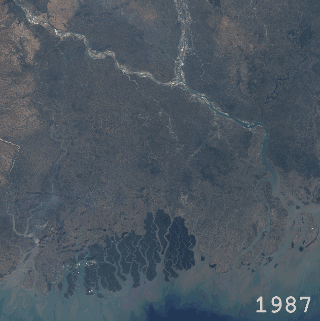 |
|---|
| Animation of composite Landsat imagery |
Below, an example of the convolutional deep learning neural network DeepWaterMap applied to Landsat imagery of the Ganges-Brahmaputra-Meghna River Delta is shown. DeepWaterMap performs objective surface water detection, a prerequisite for many different temporal analyses of river systems.
DeepWaterMap was created by Leo Isikdogan, to read more about it, check out one of the journal articles describing the algorithm and its development (2017 paper, 2019 paper).
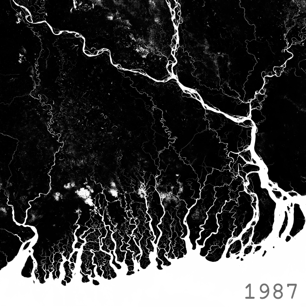 |
|---|
| Animation of surface water extents as identified by DeepWaterMap |
This process is applied to the Pearl River Delta in the below image. The composite Landsat image for each year is on the left, and the surface water extents are shown on the right. The blue number in the bottom-right corner is the percentage of the scene identified as surface water.
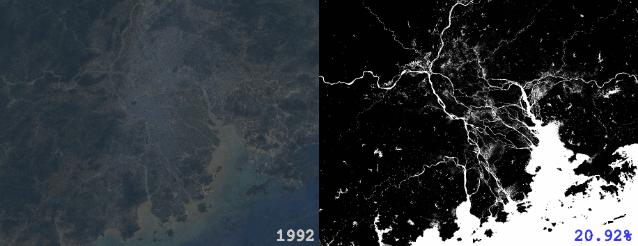 |
|---|
| Animation of Landsat imagery and surface water extents for the Pearl River Delta |
Landsat imagery and DeepWaterMap results were manipulated and animated using the open-source tools GDAL, pillow, imageio, and pygifsicle.